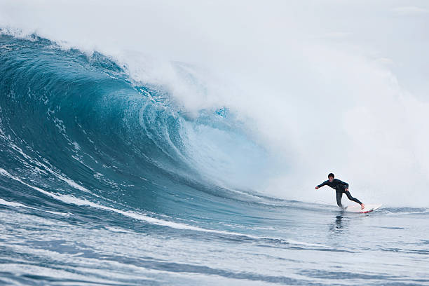
You ever notice how some days the buoys scream fifteen feet at twelve seconds and the ocean looks like a washing machine full of wet cement, while other days a modest six-footer at eighteen seconds turns your local sandbar into a freight train out of a dream? That right there is the difference between a wind swell and a groundswell, and it is the single most important piece of knowledge a wave chaser can pack in their board bag. If you are planning a run down the coast or a whole trip across the hemisphere, understanding period is the secret handshake that gets you into the club where the waves are lined up, hollow, and worth the paddle out.
We get hung up on height. It is human nature. The forecast says head high plus and you start foam at the mouth. But height without period is like a big engine with no transmission. It revs loud but goes nowhere. Groundswells are born from storm systems that blow hard over a long stretch of ocean, over hundreds or even thousands of miles of fetch. That energy travels out of the storm in organized, pure lines. The longer the distance the swell travels, the more the chop and chaos get sorted out. By the time that energy reaches your favorite point break, it has cleaned up into long, muscular lines with serious push. That push is measured in seconds, and those seconds are everything.
A classic groundswell period of fifteen seconds or more means the wave has speed down deep. It will stand up steep, it will pitch, and it will give you a wall that doesn’t crumble. That wave holds its shape all the way through the inside. You can drop in, set a rail, and feel that energy moving you forward with a authority that a shorter period wave just cannot fake. In contrast, a wind swell with a period of eight or nine seconds might have the same face height on paper, but it is a lumpy, fat mess. It rolls in like half a wave, collapses onto itself, and leaves you paddling for the next lull before you even finish your bottom turn. Locals who have been sitting in the same lineup for twenty years will tell you straight up: they watch the period before they watch the height. It is just smarter surfing.
When you are planning a trip, this is where the rubber meets the road. Say you are heading to Indonesia or Central America. The big winter swells that make places like Uluwatu or Pavones come alive are crossing entire ocean basins. They are groundswells, pure and simple. You show up on a day where the period has dropped below twelve seconds, even if it is overhead, you might find a lot of closeouts and frustration. But wait a day for the period to climb back to fifteen, and suddenly every channel is working, every reef is saying hello, and the takeoff zone is a party you actually want to attend. The savvy traveler keeps a close watch not just on the swell height maps but on the buoy readings that show the seconds ticking up. That is the green light to pull the trigger and book that last minute flight or load the car.
The hardest part is patience. We all want to chase the swell the second it shows up on the charts. But the best swells are rarely the first ones in. Often, a building swell has a shorter period early on, because the leading edge of the energy is the youngest and least organized. The real juice arrives later, once the trailing fetch has had time to settle and the long period lines begin to roll under. This is why the old salts say let the swell set up for a day. Let the ocean find its rhythm. Give the sandbars a chance to adjust. The first day of a new swell might be raw and bumpy, while the second or third day is glassy and lined up like a string of pearls. Reading the forecast is not just about numbers. It is about reading the story that those numbers are telling you. A sharp decrease in period in the middle of a swell might mean the swell direction has shifted, that the magic alignment with your local break is gone, and it is time to move to a different spot or just call it a session and live to paddle another day.
Every surfer who has ever chased a swell remembers the first time they truly understood period. It is like having the noise dial tuned out and the music turned up. The ocean starts making sense. You stop guessing and start knowing. You stop showing up for wind swell slop and start arriving for groundswell perfection. It turns a trip from a roll of the dice into a calculated strike. So next time you pull up the forecast, look past the headline height. Find the period. Let it be your guide. The best waves are out there, and they are patiently waiting for you to understand what they are trying to say.